
Walking Trails in and Around Penticton

Do you like to walk? The Okanagan is a wonderful place to walk. In this article we have covered several different areas you can go for a walk in and around Penticton and the South Okanagan. There are so many choices, so for this article we have narrowed it down to some of the most popular ones – and easier ones. If you are looking for some more challenging walks, there are plenty, but are covered in a separate article. Enjoy.
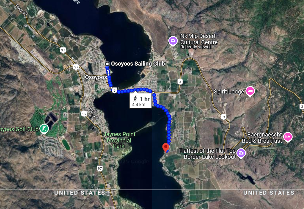
In Penticton itself, there are two lakes you can walk beside, Okanagan Lake and Skaha Lake. Each have very long, wide paths where you can walk along beside the water for quite some distance. Summerland and Naramata also have some nice walks along the water. As you go South, you will find Kaleden and Okanagan Falls where you can also walk beside the Lake. At the end of the run you will find Lake Osoyoos which is always a busy hub in summertime. and easy to walk beside. These lakes are all connected by a canal – or channel. At various spots along the way you can walk beside the canal for several miles. There are also a number of very flat railway beds that have been preserved and laid out especially for walking and biking that at times wind through the vineyards, making for a very pleasant stroll.
Click on the links below to jump straight to relevant the description, or simply scroll through:
Penticton – Okanagan Lake Front
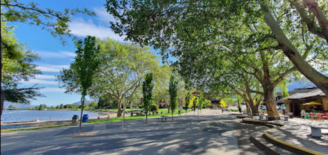
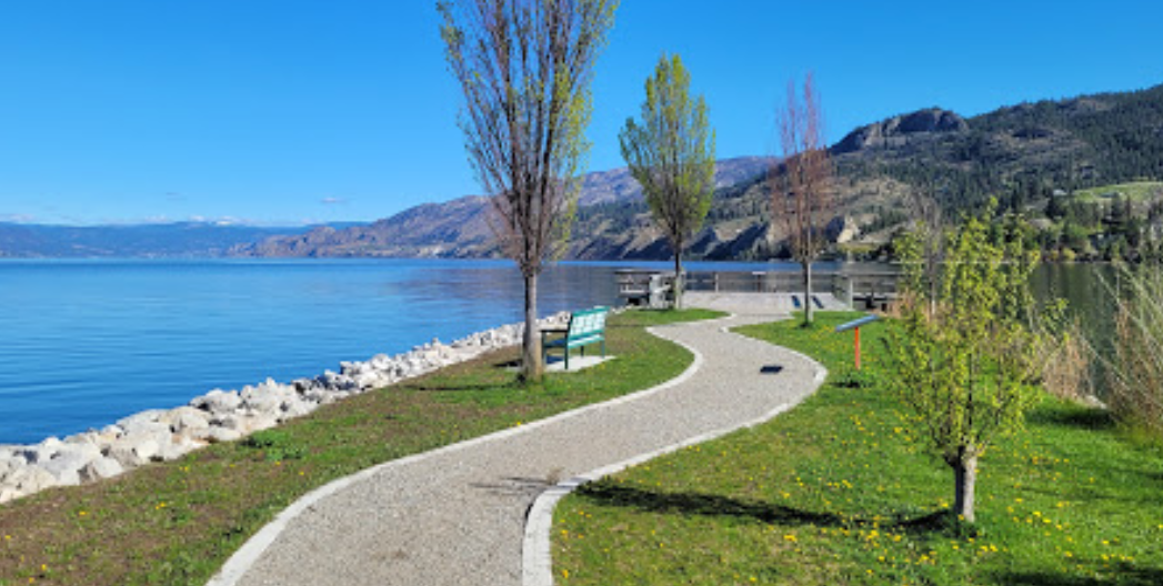
In Penticton itself, there are two lakes you can walk beside. Each have very long, wide paths where you can walk along beside the water for quite some distance. The two lakes are connected by a canal which is frequented by “floaties” in the summer months. One can walk all along this canal – or channel – all the way from Okanagan Lake to Skaha Lake. The Okanagan Lakefront is where most of the action is, as there are hotels, motels, shops and restaurants nearby. In the summertime there is always plenty of action on the beach and on the water to look at.
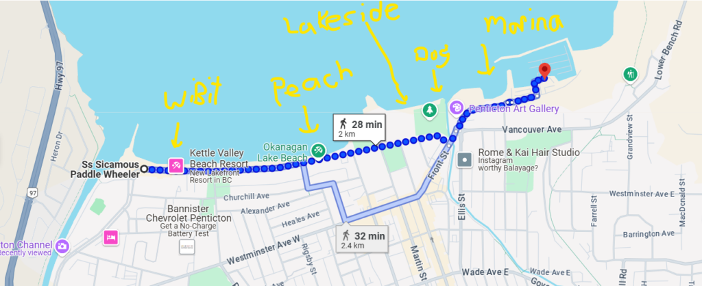
Okanagan Lakefront Walk is a flat and easy walk. The round-trip can take about an hour and there are plenty of things to stop and look at along the way.
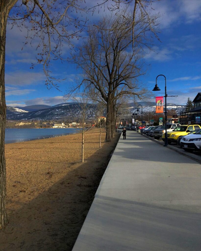

Great walk along the waterfront. In the summer this walkway can get quite busy. Mornings and evenings are a little quieter.
Penticton – Skaha Lake Front
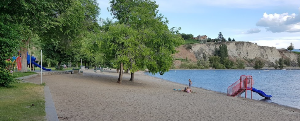
Skaha Lake is a smaller, warmer lake that boasts an excellent park where there is lots of stuff to do (for free), and a great, wide walking path. You can walk beyond the park all the way to the other side of the lakefront. There are sidewalks and paths the whole way. There are a few other beaches beyond the park, one where the kite surfers like to frequent as the parking provides close access for carrying equipment to the beach. Beyond this beach the walk is not quite as pleasant as you do have to walk beside the highway for the last bit. But it is still very scenic and can be worth doing.
Skaha Lakefront Walk is nice and wide through the park. To cross the channel you will have to go up on a sidewalk on the bridge closer to traffic so not as quiet.
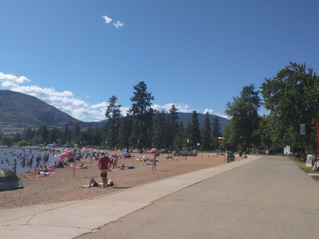
Nice, wide walkway along the beach through the park
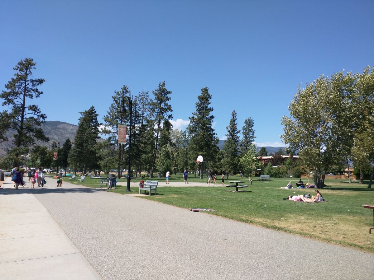
There are always lots of activities going on in the park.
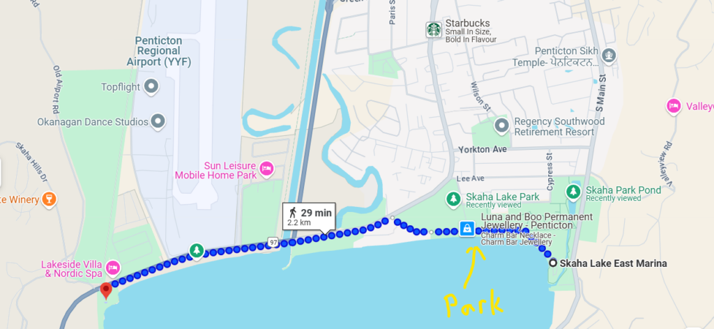
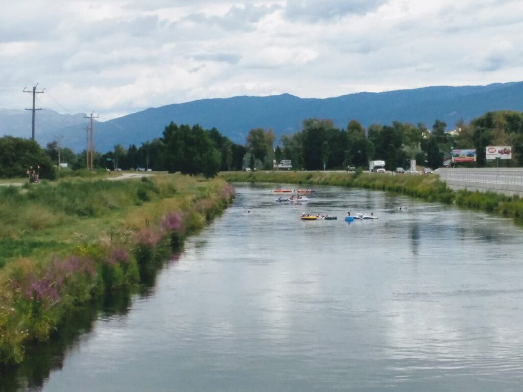
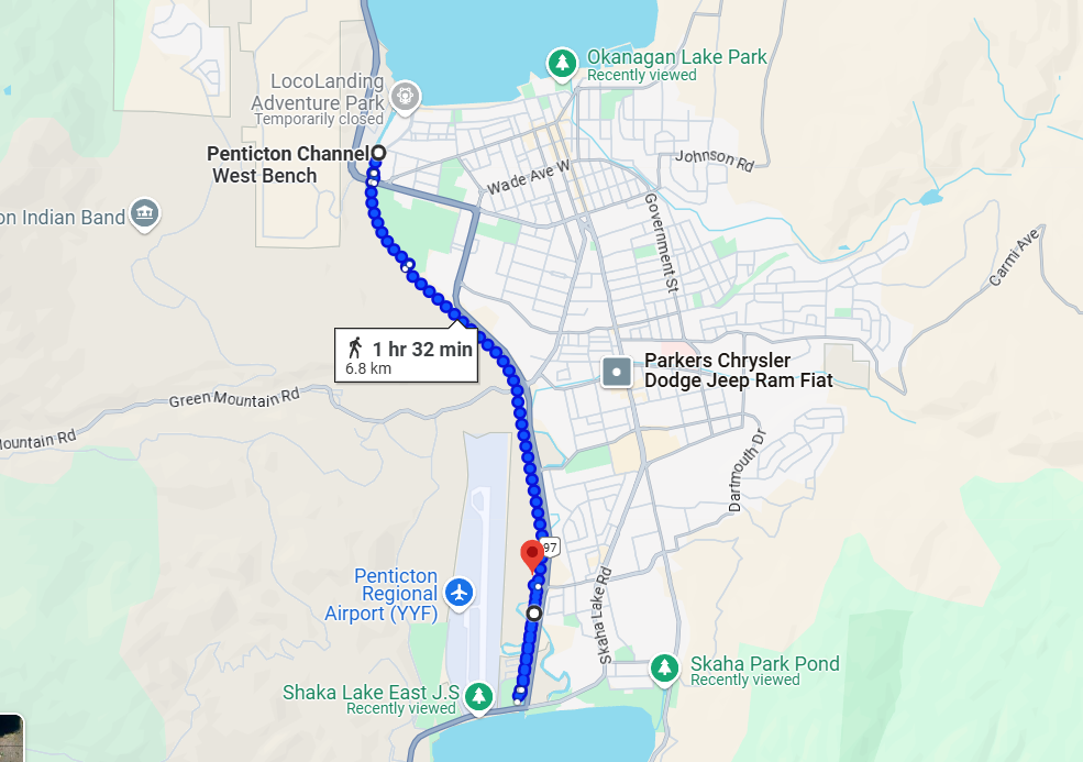
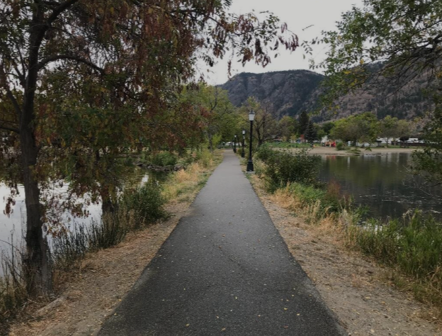
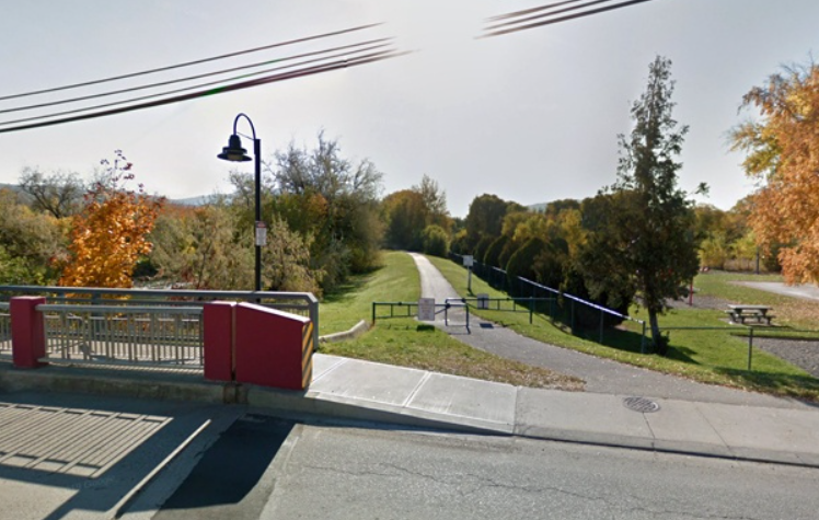
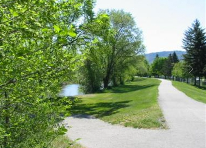
Penticton – Walk Beside the Channel
Penticton is squashed between two Lakes – Okanagan Lake and Skaha Lake. Okanagan Lake is long, winding all the way to Vernon (135 km). Skaha Lake is much smaller. A Canal joins these two Lakes, and there is a great walking path along the side of this canal. You can walk part of it, or you can walk the whole thing. The distance between the Lakes is just under 7 km and should take under two hours to do the whole thing one-way.
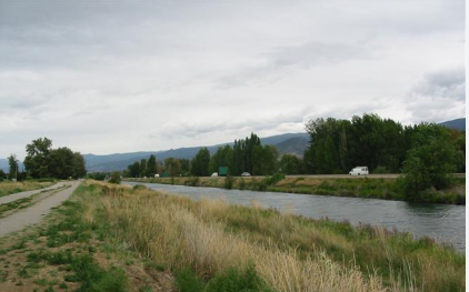
The trail varies from very wide and paved to a few bumpy spots but overall very flat.
Walk on the West side of the canal, opposite the highway. There are several (5) bridges to cross on.
This map distance starts at the floatie drop-in area. Actual walk Lake to Lake is a tad longer.
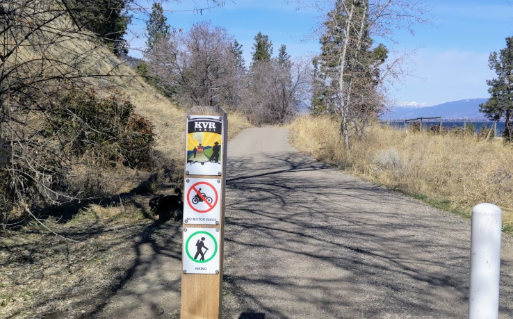
Penticton – Kettle Valley Railway Trail
On the East side of Okanagan Lake – the Naramata side – you will find the Kettle Valley Railway Trail. You can walk a portion of it, or you can walk the whole thing. The trail can take you all the way to Kelowna, so walking the whole distance is not really a “thing”. Biking it is. Usually from the Kelowna end, however, because it is downhill from there.
The stretches of trail near the town of Penticton are fairly flat. The trail is fairly easy walking all the way to Naramata, and there are various parking lots just off the trail so you can park in a specific spot and just walk a portion of the trail that day.
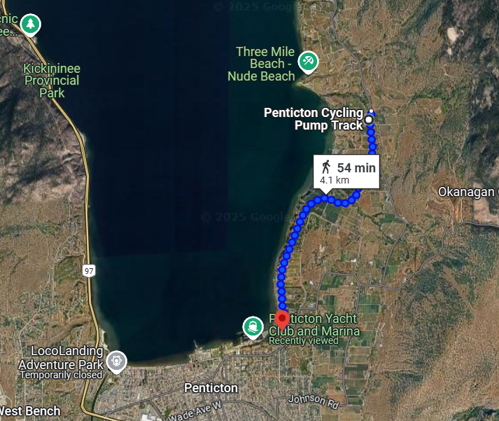
This is the most common stretch of the trail that people walk on. Easy to access. Close to town. Very flat. And you pass right by the Abandoned Rail Pub if you get thirsty.
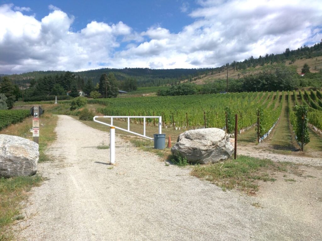
There is always lots to look at along the trail. You will pass a number of vineyards with grapes growing. There are wineries along the path as well if you go just beyond the pump track.
Bikers and walkers share the trail. There is plenty of room for all to enjoy. Bikers sometimes come all the way from Kelowna along the trail.
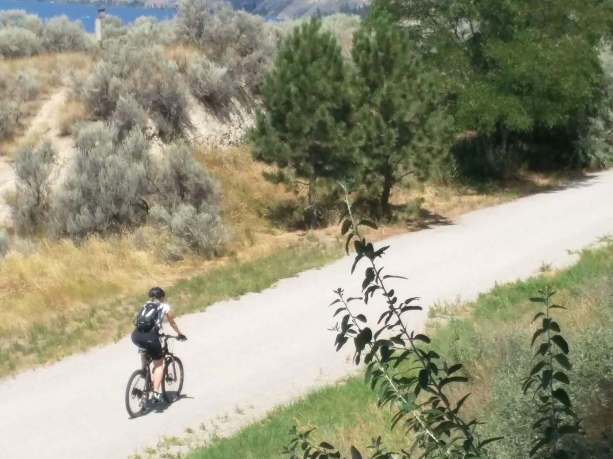
Naramata – Kettle Valley Railway Trail
Up above Naramata there is a parking lot next to the Kettle Valley Trail on Smethurst Road. From there you can take a manageable walk to the infamous Little Tunnel. A great view of the Lake and the Valley can be had from there. The parking lot is usually fairly busy with walkers and bikers enjoying the sunshine and fresh air.
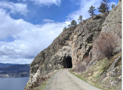
A picture of the tunnel entrance. Most people walk to the tunnels, through to the other side and then turn around.
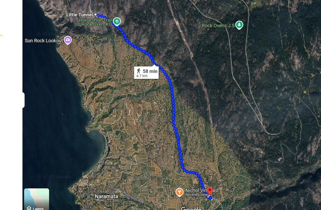
The complete walk from Smethurst Road to the Little Tunnel is pretty flat and quite enjoyable, with great views. Plan for a 2 hour return trip.
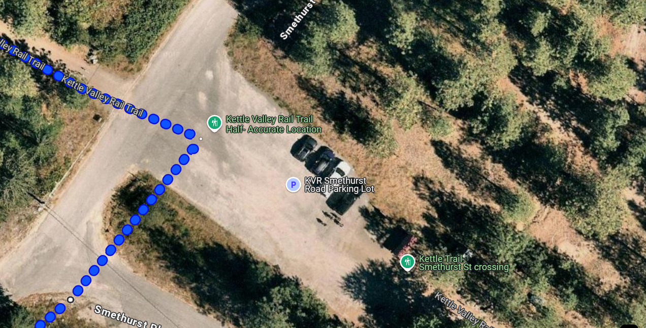
This is a picture of the parking lot you can use to walk (or bike) to the tunnel. There are many such parking lots along the KVR Trail to make it easier to walk it in sections.
Naramata – Downtown Area
Naramata does not have a walking trial that goes all along the beach front. There are a number of public beaches fairly close to each other, but for the most part they are separated by private property. That being said, there is very little traffic on Naramata roads, so walking around town is a very common thing to do.
Wharf Park is very easy to find. Just drive into town and head for the Lake.
Manitou Park is a nice, large park. It is a few blocks away from downtown. Walkable, but there is also a very large parking lot if you want to drive there.
Streets are quiet and very walkable
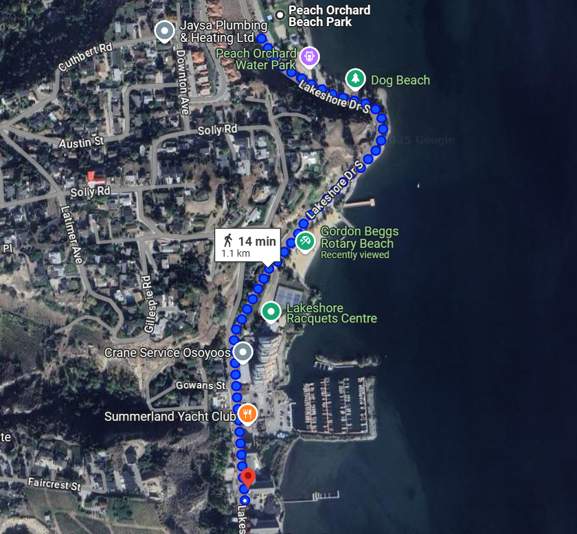
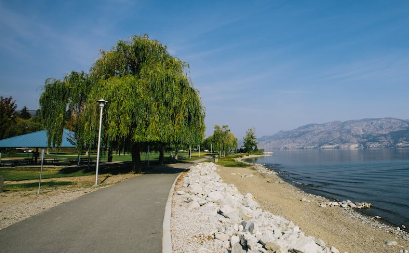
Summerland – Beachfront Area
Summerland has several great options for walking. Down by the lake you can walk past a number of great beach areas and piers. The main beach area will take roughly 30 min return to complete. If you are looking for a longer walk, you can hook up with some longer hiking trails, most notably the Centennial Loop, and the Rotary Loop. Both of these Loops involve a little bit of climbing, as Summerland is built on a hill. But both are very scenic. Peach Orchard Park would be a good starting point for either loop. There is lots of parking and a great place to return to.
Main Beach Walk is very pleasant. The walkways are wide and flat, and the scenery is fantastic.
Peach Orchard Park is a highlight of the Beach area, sporting a Dog Beach, a playground, and a splash park as well as washrooms. There is lots of parking and a nice wide walking path.
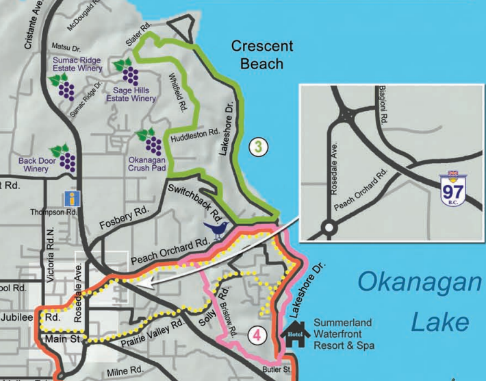
The GREEN loop is called the Rotary Lakeside Loop – 6 k, the PINK loop is called the Centennial Loop 4.5 k. They are marked in some areas.
Summerland – Giants Head Mountain
Giants Head Mountain is not a flat, casual adventure. But the view!!! During most days in the spring/summer/fall the gates are open from noon til 9 at night so that you can drive up most of the way. Be very cautious on the drive up because there are many walkers and bikers using the road. The hike from the top parking lot does go uphill, but it is not very long and most people can handle this short distance.
If you wish to walk from the bottom, there is a nice parking lot at the base and it is only 5 km return. The issue is simply that the hike is fairly steep so it is not for everyone. This hike is very popular. It is best done on a cool, clear day in the spring or fall.
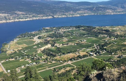
On a nice clear day the views from Giants Head Mountain are stunning. It is well worth the effort.
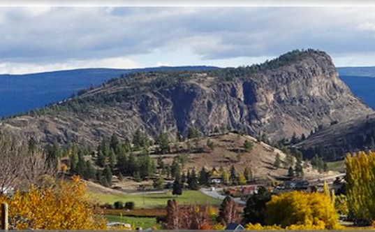
Giants Head Mountain is a landmark in Summerland and is often used as a navigation tool as one drives the roads in and around the town.
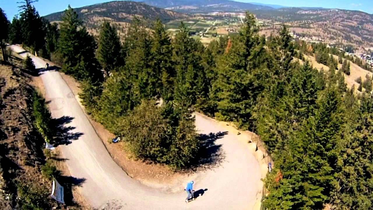
The road up the mountain is nicely paved, but is not very wide and there are often many hikers and bikers using the road as well. Drive with caution.
Summerland – Ornamental Gardens
On the way into Trout Creek from Penticton you will spot a very large Federal Government sign that says “Summerland Research Station”. If you turn onto this road and drive up the hill past the research facility you will arrive at the Ornamental Gardens. Theses gardens are volunteer run and open for public visitation – for free. As you walk through the gardens there are signs and labels so you can identify what you are looking at. The Gardens are situated on Federal Land and was once part of the research station. It was converted to a not-for-profit in 1991.
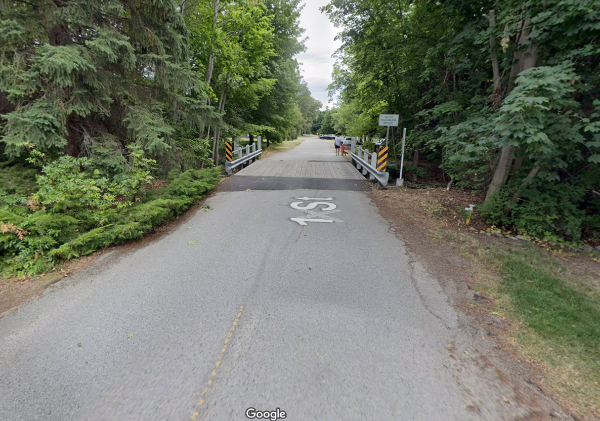
The Kettle Valley Railway Trail runs right past the Ornamental Garden area, and the Trout Creek Trestle is proximate. At certain times of the day you will be greeted by the Kettle Valley Railway Steam Train crossing the bridge, and then backing up to the other side again, as the railway line ends just after crossing the bridge. You can walk across the bridge to the other side. The view is quite scenic. The train runs twice daily in the summertime – usually showing up at the trestle just after 11 am and 3 pm.
The KVR Trail goes a long way in either direction – either to Penticton/Kelowna, Penticton/Osoyoos or North to Princeton. The railway portion is 16 km. The rest is a great walking/biking path and also part of the Trans Canada Trail. From the Ornamental Gardens the walking path in the direction of Penticton is nice and wide. You can walk a portion of it and turn around. .

The turnoff to the Gardens is at the Research Station, just before Trout Creek when coming from Penticton.
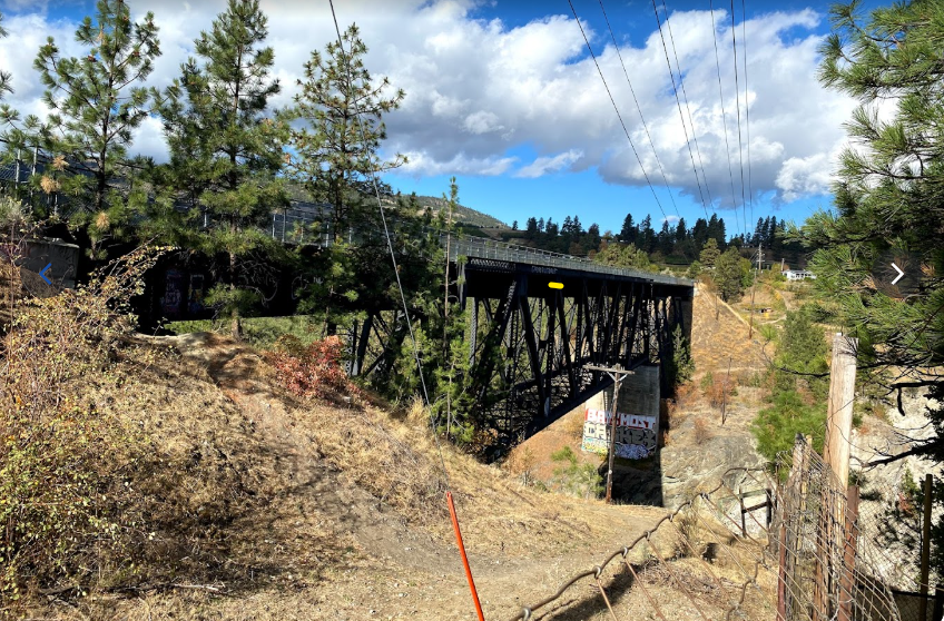
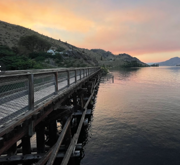
While visiting the gardens, you can get access to the Trout Creek Trestle, a bridge built for the railway back in 1915
The trestle is walkable and is quite scenic. When the train arrives it can get quite busy as the passengers hop off to take pictures.
Okanagan Falls to Penticton – Kettle Valley Railway Trail
There is also a railway trail that joins Okanagan Falls with Penticton. To walk the entire distance one-way, it would take just over 3 hours. There is also a half-way break as the Trail goes right through the town of Kaleden. You can park at the waterfront in Kaleden and explore the trail in either direction. To walk half the trail would only take around 90 minutes one-way. If you have access to two vehicles you can put one at either end so that you have a ride home after you go one way.
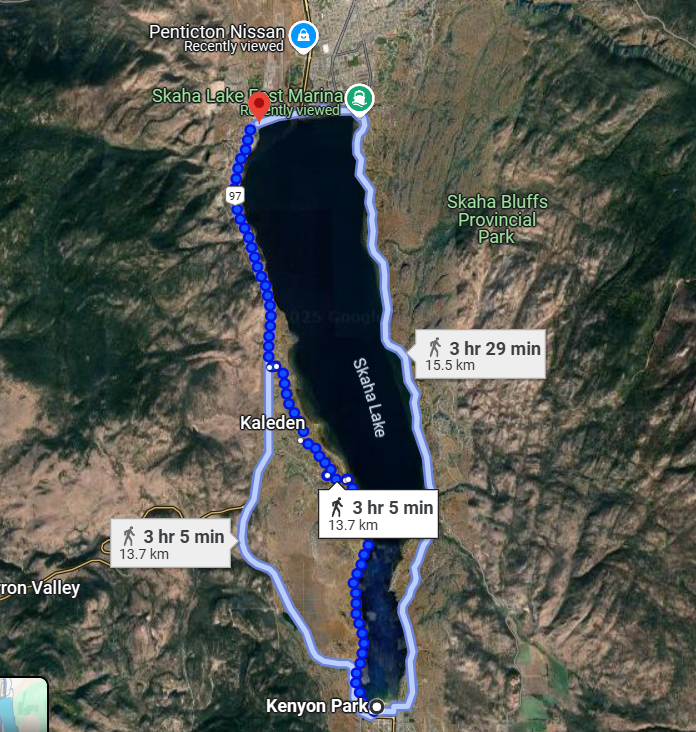
The trail is fairly flat most of the way and wide enough to walk on. It also fairly well-marked. I goes beside Skaha Lake the whole way.
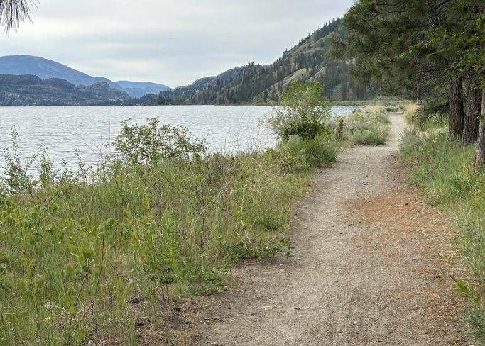
In some spaces along the way the trail is not as kept-up as it is not used as often, but it is still flat and easy to navigate.
Okanagan Falls – Kenyon Park
In the heart of Okanagan Falls in Kenyon Park. This Park boasts plenty of beach access to Skaha Lake, as well as a playground, a splash park, and a Dog Park. This is also a great place to hop on the KVR trail and go for a short walk towards Kaleden and back. The highlight of the trip is a walking/biking trestle that crosses the canal that joins Skaha Lake with lake Vaseaux.
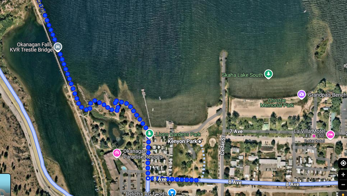
You can park in Kenyon Park at Okanagan Falls, walk through the park and a small distance up the KVR trail and turn around. This is a very nice walk.
The trail is fairly flat most of the way and wide enough to walk on.
Between Okanagan Falls and Oliver – Lake Vaseaux
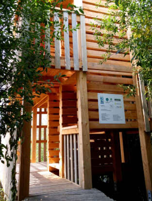
Lake Vaseaux is the lake you will find on the way to Oliver from Okanagan Falls. It has a number of walking trails and even a bird sanctuary with trails you can walk on with signs describing the local habitat as well as a little building with a platform you can climb up on to “get a birds eye view”.
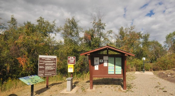
There is lots of parking and also toilets available, which makes this a great rest stop for a stretch and a break.
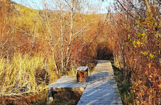
There is a very pleasant walk through the marshes on raised platforms.
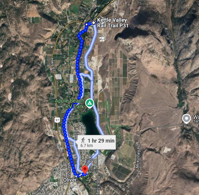
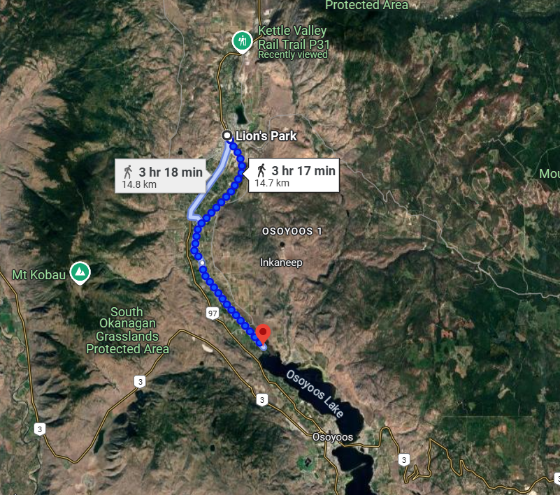
Oliver – Walk Along the Canal
There is a long canal that joins Lake Vaseaux and Lake Osoyoos. The town of Oliver is situated right in the middle of this stretch. The canal is carefully controlled with damns, and has walking paths on either side. Along the way, there are a number of bridges such that you can walk down the canal in one direction, cross over at some point and walk back on the other side of the canal. The entire distance of the canal trail would be a 4 hour walk. But there are lots of opportunities to park somewhere and jump on and off the trail for a shorter walk,

The entire trail may not be realistic to walk in one day. But it can be done.
The entrance to the trail has a parking lot very close to Jackson Triggs Winery in Oliver. You can park there and walk as far as you’d like down the path and return.
One easy entrance to the trail is at Lions Park in Oliver. Lots of parking and a very pleasant walk. You can go either direction.
Osoyoos – Walk Beside the Lake
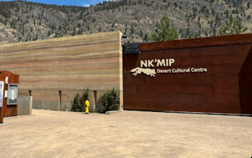
Osoyoos has several great options for walking. First and foremost you can walk a long ways along the lake. and there are several different spots you might want to park and explore. NkMip winery also has a nature discovery center (fees involved) where you can walk around and learn more about the natural habitat of the area.
Osoyoos is not a very big town, so walking around is very easy
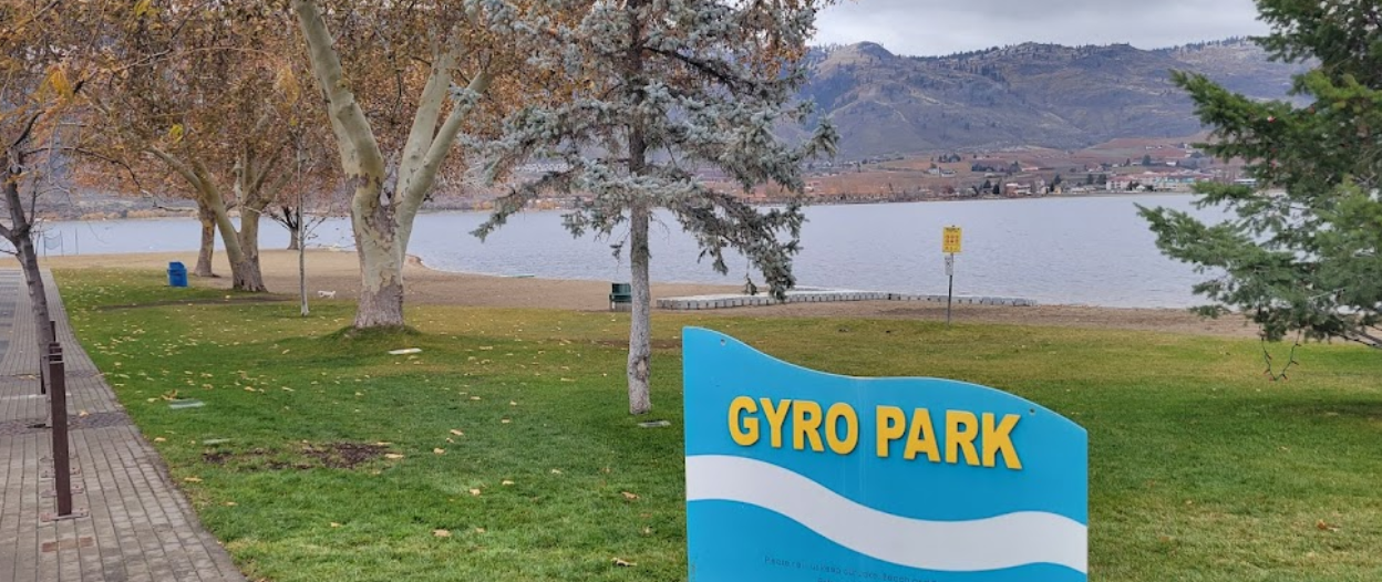
One of the favourite areas to hang out in the summer is Gyro Park, right in the center of downtown. A nice park to walk through, and can be combined with walking to other beach areas.
NkMip also has a nature walk you can take with signs and information stops along the way.
This concludes this expose of walking trails in the south Okanagan. Hope you enjoyed this. Now get out and have some fun.